On a day trip to the city of Birmingham in England, intent on seeing the Bullring shopping centre and Future Systems' Seifridges building, I had discovered a large construction project underway in Centenary Square - the largest public square in the heart of Birmingham. Interestingly, this urban square hosts, or adjoins, numerous performance halls and cultural institutions of the city: The Repertory Theatre, Symphony Hall, International Convention Centre (ICC), Town Hall, Central Library, Birmingham Museum and Art Gallery, and the Baskerville House (Civic Centre). Originally designed in the early 20th century, the city council envisioned this area as a grand civic scheme - an urban territory for grand buildings and significant institutions. Today, Birmingham has grown to the second largest British city outside the capital London, densifying the urban core and expanding its metropolitan limits. The growing city fabric and condension of the city's cultural institutions has created a lack of cohesion and clear identity on Centenary Square, creating a strip-mall of grand buildings with little connection to the surrounding city.
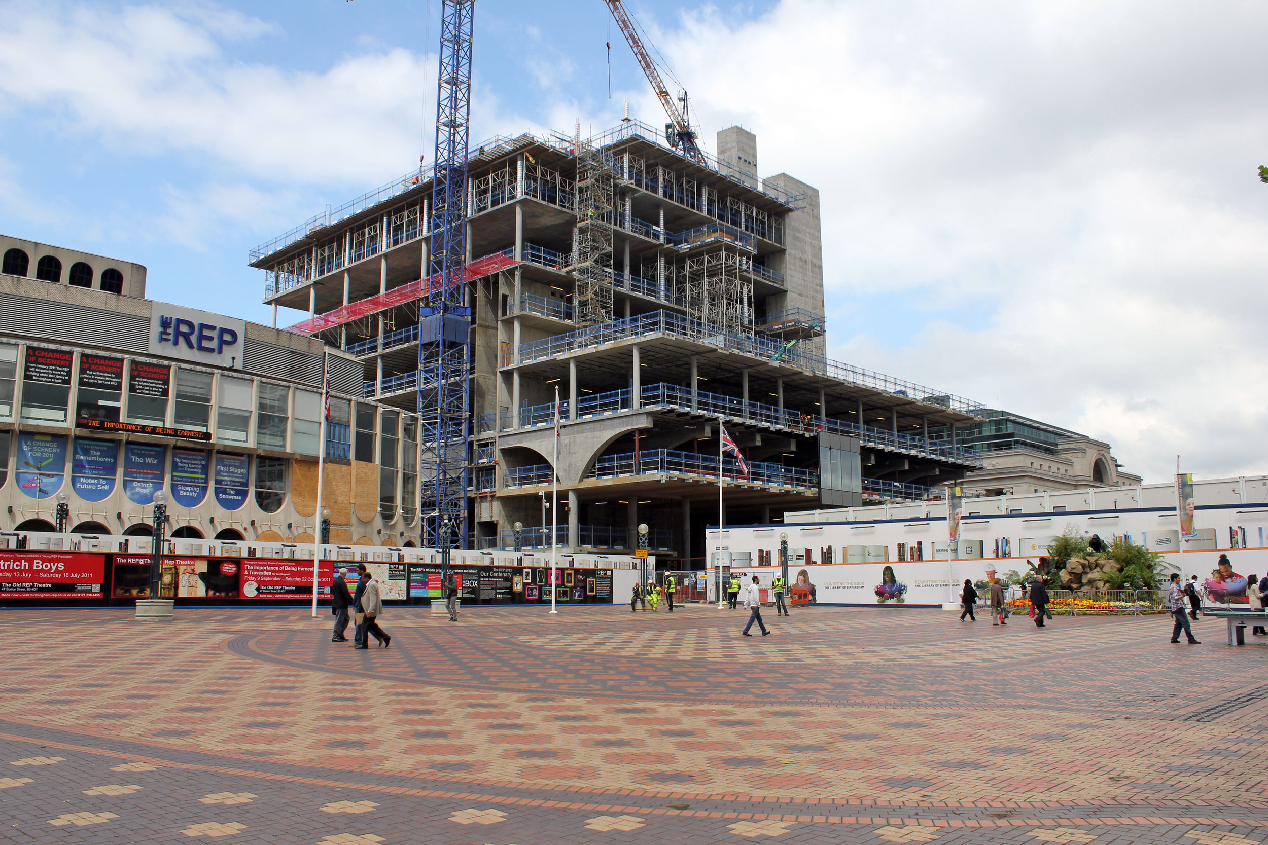
The library as viewed from Centenary Square / August 2011

Rendering of proposed design by Mecanoo

View towards the East of Centenary Square, Symphony Hall
When the Birmingham Central Library decided on relocating due to physical restraints, the original plan was to build a new library in the emerging Eastside district by Rogers Stirk Harbour + Partners, focused on urban linkages and public activity. However, financial concerns and reservations about the location would sink the project. Years later, a new site would emerge on Centenary Square, between the Repertory Theatre and Baskerville House, as the new home for the library. Shrouded in banners proclaiming "Birmingham: Global City, Local Heart", the project is viewed by council leaders as the "the flagship for the regeneration of Birmingham", hoping to highlight the city's intellectual and cultural credentials and draw more visitors to the city. Nearing completion by 2013, the Library of Birmingham will tower over Centenary Square with capacity to accommodate more than three million visitors a year, making the structure Britain's largest public library and a clear sign of the continuing global renaissance in the construction of grand civic building. The architects of the project, Mecanoo, explains that their design, projecting a delicate glass/filigree skin inspired by the artisan tradition of the industrial city, will "transform the square into one with three distinct realms: monumental, cultural and entertainment."
You can checkout a flythrough video of the project design here.

Cultural Condensation: Centenary Square