• About
  • Resume
  • Rotch Summary
  • Vignettes
  • Blog

C KARLSON

An Architectural Journey

  • About
  • Resume
  • Rotch Summary
  • Vignettes
  • Blog

Context / Rome, Italy

Aerial of Rome's historic city center

Aerial of Rome's historic city center

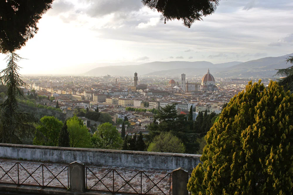
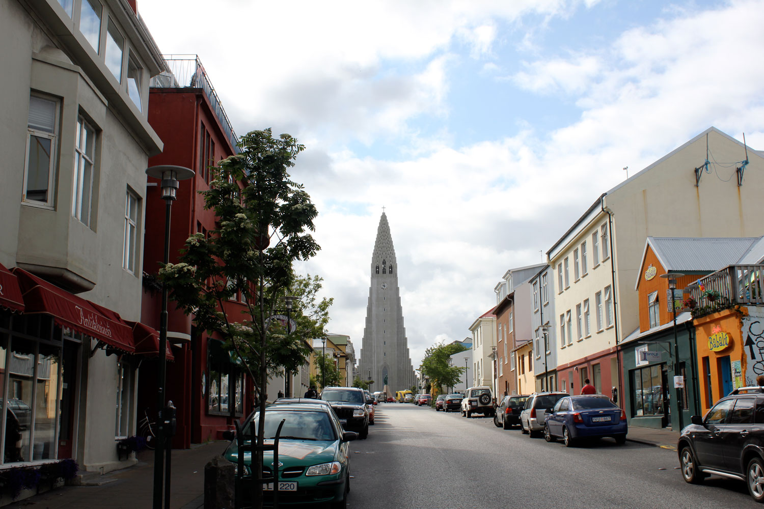
Carrying the weight from almost 3,000 years of influential history, the city center of Rome (Roma) still seduces with a mixture of abounding antiquity, village-like sentiment and stylish metropolitan flavor. Centrally located off the western coast of the Italian peninsula, the city sprawls out of the Tiber River about 15 miles inland from the Tyrrhenian Sea, blending with the adjacent hillsides known as the ‘Seven hills of Rome’. The city’s beginning’s can be traced back to the 9th century BC as a conglomerate of small Latin settlements from the neighboring hilltops, eventually bonding together to become the heart of Italy’s historic urban evolution, from ancient Rome (the Roman Kingdom, Roman Republic, Roman Empire), and later to the Papal States, Kingdom of Italy and today’s Italian Republic. 

Piazza del Campidoglio

Piazza del Campidoglio

Ruins of the Basilica Ulpia (ancient Roman civic building located in the Forum of Trajan)

Ruins of the Basilica Ulpia (ancient Roman civic building located in the Forum of Trajan)

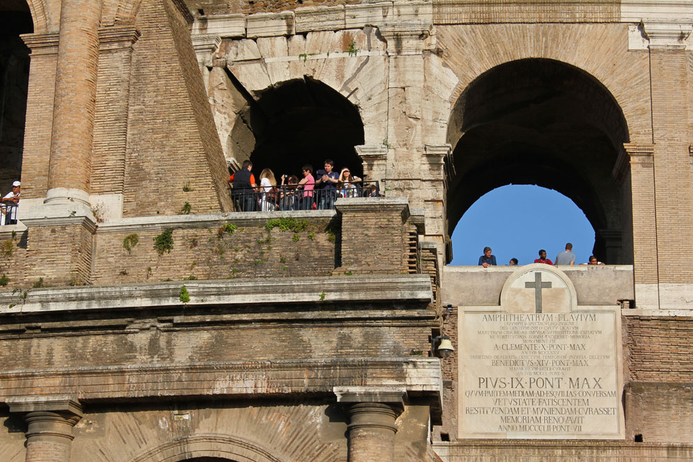
At the height of power during the period of the Roman Empire, the capital city headed the Western world’s first legitimate superpower - extending from Britain in the north to North Africa in the south - leading to a massive influx of imperial goods and cultures from a myriad of civilizations - condensing the riches of an entire continent into one metropolitan center. Likewise, every leader of the city (from emperors to popes) have left their personal mark on Rome, leading to an urban accumulation of civic/artistic works within the city walls - Triumphal arches, large basilicas, elegant sculptures, ornate palaces, massive sporting venues - all defined the monumental character of the city and formed an ancient urban structure with limited comparison. 

The Spanish Steps (Scalinata della Trinità dei Monti) and the Trinità dei Monti church

The Spanish Steps (Scalinata della Trinità dei Monti) and the Trinità dei Monti church

The Roman Colosseum
IMG_1303_Snapseed.jpg
IMG_0520_Snapseed.jpg
IMG_0458_Snapseed.jpg
IMG_0368_Snapseed.jpg

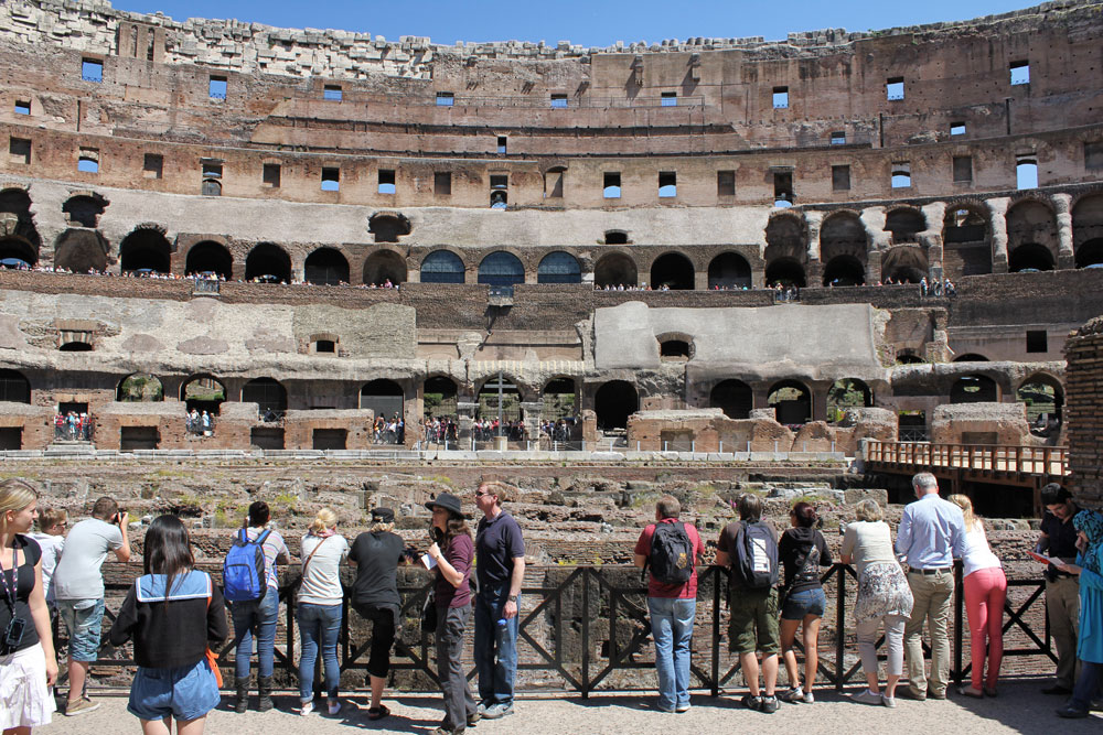
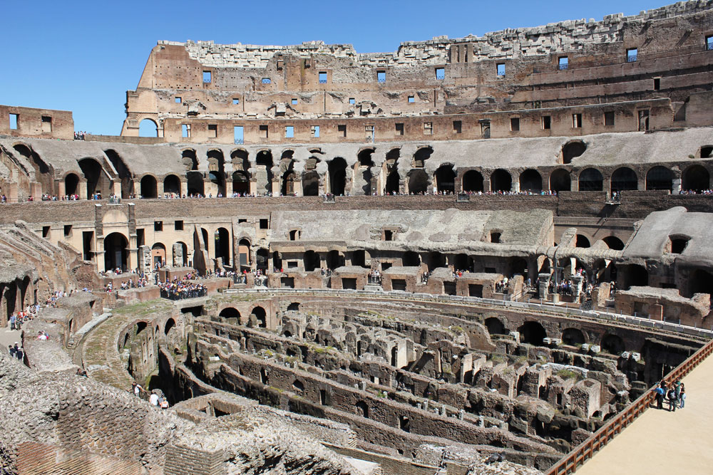
Today, often referred to as the ‘Eternal City’, Rome is still an eclectic place - full of of great artistry, diversity and civic activity. The urban core is the memorialized capital of the Lazio region, the center of Roman Catholicism, and the political capital of the entire Italian Republic, shaping it as the most populated and transient of modern Italian cities. Central Rome is geographically divided into several municipalities - with the reasonably unscathed historical center (the Forum, Colosseum) at its core - in order to decentralize the government’s administrative duties and districtize the city’s many historical urban milestones. Lying 6 miles equidistantly from the city’s geographic center of Capitoline Hill, a massive orbital highway (GRA) encompasses Rome’s abundant city districts and brings clarity to a web of historic boulevards and small access roads - most remnants from the Roman Empire when ‘all roads lead to Rome’ - with the final sections of the sixty-year highway project completed in 2011. 

St. Peter's Basilica and Square

St. Peter's Basilica and Square

Aerial of St. Peter's Square in Vatican City

Aerial of St. Peter's Square in Vatican City

Vatican Museum - Spiral Staircase by Giuseppe Momo

As with many post-WWII Italian cities, Rome was struggling with constraints to build new facilities for a growing population, while also preserving the country’s substantial natural beauty and ancient remains. However, the construction of the GRA, along with a new underground metro system, would help alleviate a city plagued with perennial housing shortages and critical traffic congestion, with an influx of new residential buildings (albeit hastily and unsightly constructions) clustering around the orbital road in Rome’s freshly-anointed suburbs - an explosion of new growth outside the ancient core. Rome is now ringed by a thick band of residential and commercial developments - a modern equivalent to the old city walls - keeping a delicate balance between the museum-like city center and contemporary urban living. 

The Fontana del Pantheon in the Piazza della Rotonda

The Fontana del Pantheon in the Piazza della Rotonda


tags: City Context
categories: Italy - Rome, Rotch City Contexts
Tuesday 05.22.12
Posted by Christopher Karlson
 

Context / Florence, Italy

IMG_8954_Snapseed.jpg

An urban-sized shrine to the Italian Renaissance movement, the city of Florence is famous for its prosperous cultural history and nostalgic appeal. Equidistant from Rome (south), Venice (northeast) and Milan (northwest) by just over 150 miles respectively, Florence is firmly established in the heart of Italy’s north-central Tuscany Region along the shores of the River Arno, famously surrounded by undulating hills covered with historic villas and twisting vineyards. In that centrality Florence would grow from a small Roman military colony (1st century BC) to the center of Medieval European trade and finance - making it one of the richest cities of that time. It was in those riches that affluent mercantile families - including the famous Medici family - and politicians began overwhelmingly supporting civil-minded artistic endeavors that would be a testament to the city’s passion for religion, art, power and currency. This would be known as the beginning of the Italian Renaissance. Great historical Florentine artists like da Vinci, Michelangelo, Botticelli, Dante, Galileo, Donatello, Amerigo and Brunelleschi., just to name a few, would all benefit and contribute to this defining period of time. To this day, the majority of the city’s monuments, churches and buildings were built during the Renaissance period - including the imposing domed cathedral, Santa Maria del Fiore (The Duomo) - with the heart of the city still in the Piazza della Signoria. It is a testament to the honesty in cultural and civic conviction that a small city of merchants and artists without political will or military power rose to a position of enormous influence in such a volatile time in Europe. 

Ponte Vecchio

Ponte Vecchio

Pazzi Chapel

Pazzi Chapel

Statue in the Piazza della Signoria

Statue in the Piazza della Signoria

Today, Florence (Firenze) is the regional capital of Tuscany and most populous city in the region. The city has remained an important cultural and economic force into modern times. Often referred to as the ‘Athens of the Middle Ages’ , ‘Art Capital of the World’, and the ‘Cradle of the Renaissance’, Florence contains a wide range of art collections from over 80 museums within the city limits - especially from the Pitti Palace and the Uffizi - that cover over fifteen centuries of homegrown cultural value. This appeal, along with a strong infrastructural network that connects northern and southern Italy, has shaped the historic city center economically dependent on tourism (the largest industry in the city) and international academic programs, while the peripheral areas around the urban core continues to grow and modernize into a strong industrial / manufacturing district. Foreign visitation and pedestrian traffic had advanced so much (now over 1.5 million a year) that the city was compelled to close the historic section of the city to vehicular traffic in the 1980s, straining  the main highway (Autostrada del Sole) as the primary route to pass west and south of the urban center. Florence seems to be in an ongoing battle for identity - between a booming tourism market aimed to capitalize on the past and the civic pride of the city that does not want to lose its distinctive character and artisan values to trinket shops. The city has become a  victim of its own successes, but still exerts a powerful influence from its artistic and architectural heritage that inspires thousands of students on the Renaissance ideals of empowerment and rediscovery, as it did hundreds of years ago. 

Giotto’s Campanile

Florence Cathedral in Piazza del Duomo

Florence Cathedral in Piazza del Duomo

Aerial of city from the top of Brunelleschi's Dome

Aerial of city from the top of Brunelleschi's Dome

'The Last Judgment' fresco on the Florence Duomo ceiling

'The Last Judgment' fresco on the Florence Duomo ceiling


tags: City Context
categories: Italy - Florence, Rotch City Contexts
Thursday 05.10.12
Posted by Christopher Karlson
 

Context / Lucerne, Switzerland

Just an hour south of Zurich by train, Lucerne sprawls along the shores of Lake Lucerne, surrounded by an imposing Swiss Alpine landscape in north-central Switzerland - most noticeably Mount Pilatus and Rigi. The city’s urban development traces its lineage back to a modest 8th century Benedictine cloister named St. Leodegar monastery. A small fishing village would begin to independentally grow around the monastery and down the Reuss River. By the 14th century, migration between northern and southern Europe made Lucerne’s location ideal for a bustling trading center. Medieval fortifications began to rise up at the mouth of the river, leading to the iconic angled wood bridges with defensible capabilities across the Reuss River that still define the city today. Upon joining an alliance with neighboring cities in the region - referred to as the “Swiss Confederacy” - Lucerne became a self-sufficient and democratically-held city leading to an era of expansion and infrastructure development.      

City Boat Docks

Luzern Fountain

Pedestrian waterfront along Schweizerhofquai

Today, Lucerne is the capital of the Canton of Lucerne and the most populous city in Central Switzerland, with major networks in transportation, telecommunications, and government activities for the region, as well as a major destination for international tourism. Other than automobile, excursions in the area of Central Switzerland go through Lucerne’s central train station, bringing in swarms of tourists in search of nostalgic amusement. The city’s main draw - the well-preserved medieval Old Town - is located just north of the Reuss River, still exhibiting original half-timber building, exhausted remnants of old town fortification walls / watch towers scattered from the city to the hillside beyond, and famous historic covered bridges (the oldest in Europe). However, Lucerne doesn’t just dwell on the past, with new progressive developments such as the new cultural and congress center (KKL) on the south bank of the river that delivers fashionable international magnetism to the historic city throughout the entire year, even hosting some of Switzerland’s more acclaimed music events.

Aerial of city

Pedestrian Bridge - Rathaussteg

Historical covered footbridge - Kapellbrucke (Chapel Bridge)


tags: City Context
categories: Rotch City Contexts, Switzerland
Tuesday 04.24.12
Posted by Christopher Karlson
 

Context / Hamburg, Germany

Aerial of Hamburg

Aerial of Hamburg

By all measures, Hamburg is a water-centric city - historically, geographically, and atmospherically. Lying on the Elbe River (just 60 miles from the North Sea), Germany’s second largest city has had a long history as a major port and trading center for central Europe - often referred to as the country’s Gateway to the World. The city was first established as a Saxon moat-fortified earthwork ‘Hammaburg’ around 825 AD as protection from the raiding Vikings of the Scandinavian North. Hamburg’s mercantile aspirations would develop five hundred years later, when it assisted in creating (along with the city of Lübeck) a precursor to the powerful Hanseatic League of trading cities - a medieval trade alliance in Northern Europe - that would be the foundation of the city’s wealth and prosperity in the past centuries. In 1266, England granted Hamburg’s trading bloc to expand mercantile offices in London and made them the only Germans to have a reserved place at the London Stock Exchange, further expanding their trading routes to Western Europe. By the end of the Middle Ages, Hamburg was becoming a major economic power in Northern Europe, developing an independent infrastructure - including its own stock exchange and bank - and continued to grow by broadening its trading connections across the world. Today, the city boasts the second largest port in Europe (after the Port of Rotterdam), making it one of the richest metropolitan areas in the European Union and Germany’s leading media hub. Thanks to the city’s advantageous location as an international hub of travel - located on the southern point of the Jutland Peninsula, between Continental Europe to the south and Scandinavia to the north, bounded by the North Sea (to the west) and Baltic Sea (to the east) - over 100,000 enterprises from numerous sectors have called Hamburg home - such as logistics, financial, life sciences, aeronautical industry, media and IT. Hamburg’s maritime spirit had dominated its past but is also helping to shape its future, evolving from an old industrial port city to a sophisticated urban maturation - with new waterside developments and contemporary designs that see it detract the spotlight from Berlin, Frankfurt and Munich. 

City Canals along the Am Sandtorkai

City Canals along the Am Sandtorkai

Port of Hamburg

Port of Hamburg

The Nikolaifleet

The Nikolaifleet

Visitors looking for Old World Europe appeal will not find it it Hamburg. About a quarter the city’s medieval center was virtually destroyed by the 4-day “Great Fire” in 1842, followed by World War II Allied bombing that decimated the remaining historic city. Today’s city center - originally formed by damming the Alster River that created two large artificial lakes - is a mixture of vibrant neighborhoods inundated with multicultural eateries, cosmopolitan commercial areas and affluent retail shops. Historical canals, estuaries and rivers define most of the city, complemented by a reported 2,500 bridges - more than Amsterdam, London and Venice combined. Rebuilding efforts have also made Hamburg the greenest city in Europe with nearly 50% of its surface area marked by landscape features that includes some 1,400 parks and gardens. In 2011, the city was voted the European Green Capital and is used as a case study for other large densely populated urban areas to achieve continued economic growth with smart technologies and environmentally sound concepts. The key industries for Hamburg being on-and-offshore wind energy production and a clean public transportation plan to reduce carbon emissions. 

Der Spiegel Headquarters by Henning Larsen Architects

Der Spiegel Headquarters by Henning Larsen Architects

Sievekingplatz

Sievekingplatz

Planten un Blomen (47 hectare park in center of Hamburg)

Planten un Blomen (47 hectare park in center of Hamburg)


tags: City Context
categories: Germany - Hamburg, Rotch City Contexts
Saturday 04.07.12
Posted by Christopher Karlson
 

Context / Valencia, Spain

IMG_7699.jpg

Valencia. Spain’s third-largest city has long waned in the shadows of neighboring metropolitan areas - Madrid (political capital) and Barcelona (economic capital). However, laying on the fertile banks of the Turia River on the east coast of the Iberian Peninsula, the city has always been a centralized and sought-after resource with strong maritime connections to the rest of Europe. Like most Spanish cities in the region, Valencia has had a lengthy and transformative past starting as a prosperous Roman colony two millennia ago, leading to Moorish rule in the 8th to 13 centuries, the center of the Christian kingdom of Valencia during the middle ages, the capital of the Republic during the Spanish civil war, and currently the capital of the autonomous community of Valencia. Recently, the city’s maritime culture has grown globally with one of the busiest container ports in Europe and the largest on the Mediterranean Sea, filling the Gulf of Valencia with numerous cargo ships along the eastern edge of the city. But, despite having vast access to the Spanish coastline, the spirit and historic urban core of the city is not necessarily integrated thoroughly with its beaches - like its Catalonian neighbor to the north - with significant urban development of historic Moorish/Gothic/Baroque-accented city districts focused further down the mouth of the Turia River. 

Plaza de la Reina

Plaza de la Reina

Valencia Cathedral

Valencia Cathedral

Street parade in downtown Valencia

Street parade in downtown Valencia

Toward the end of the last millennium, the city that was widely overlooked by its larger urban siblings for so long was ready to mature. Perceived economic neglect by the central government (Valencia had the lowest investments in Spain) the city took charge - with increasing worldwide capital gains, cheap available credit and pride in turning a once little-considered place to becoming a cutting edge city - the Valencian government began to invest heavily on large-scale development and urban ‘beautification’ projects throughout the city with ambitions on gaining international interest and establishing itself as the ‘cultural capital’ of Spain. An economy once known for its industries - textiles, ceramics, toys, food, leather goods, etc - was instantly spurred by tourism and construction (accounting for up to 14% of employment in city), leading to a reciprocal expansion of telecommunications and transport infrastructure, with a significant share of capital reinvested in those sectors. Now, a city that hadn’t had a highway to Madrid until 1997, has more miles of high-speed train tracks per capita than anywhere in the world - including a new high-speed rail service linking Madrid (about 200 miles) to Valencia, making it easier for seaside tourists to visit and experience the refurbished city. Major investment would also be made to promote international events - such as the America’s Cup yacht race and the European Gran Prix - that now frequents the city’s Mediterranean shores, bringing international notability to the city that longed-for attention. In the last decade, Valencia had not seen such a building boom like this since the Middle Ages - a time when impressive Gothic structures, such as the medieval church of Miguelete, were constructed throughout Valencia’s urban center - but a faltering world economy would soon transpire, forever changing the city’s ambitious and idealistic urban evolution.  

Plaza del Mercado

Plaza del Mercado

Chipperfield's Veles e Vents (America's Cup Pavilion) in the city's new urban marina

Chipperfield's Veles e Vents (America's Cup Pavilion) in the city's new urban marina

On top of the Torres de Serranos (old city gate)

On top of the Torres de Serranos (old city gate)


tags: City Context
categories: Spain, Rotch City Contexts
Friday 03.23.12
Posted by Christopher Karlson
 

Context / Porto, Portugal

Panorama17.jpg

At the mouth of the Douro River sits the historic hillside city of Porto, home to one of the oldest urban centers (Ribeira district) in southern Europe and the second-largest city in Portugal. A mercantile city at heart, the area is strongely affected by its proximity to the Atlantic Ocean, boasting a variety of architectural and cultural influences that have evolved for over a millennia. Originally founded by the Romans as a administrative and trading center under the name Portus (port), the city has seen a variety of urban development from numerous stylistic periods and militaristic conflicts by successive groups including the Swabians, Visigoths, Normans, and Moors. By the 11th century, the region would firmly be established as part of the Castilian realm after the crusade to drive the Moors out of Portugal and become part of a new kingdom. The first period of expansion would soon follow with the construction of a new town wall protecting the two urban nucleai - the medieval town and harbor area, making the entire city an impenetrable-like fortress, a component whcih can still be felt today.

Porto’s Ribeira District with Clérigos Tower

Porto’s Ribeira District with Clérigos Tower

Boats along the Douro River waterfront in Vila Nova de Gaia

Boats along the Douro River waterfront in Vila Nova de Gaia

The complexities of the area’s landforms aided in this construction with a variety of buildings/walls built into the cliff faces that overlook the river, creating a maze of steep stairs and narrow cobbled streets that cut into the stone itself and run up and down the cliff. Today, the Ribeira Dirctict (a World Heritage site by UNESCO) still remains intact with a mixture of Roman ruins, medieval relics, soaring bell towers, extravagant baroque churches and venerable town houses piled ontop of one another, while a renewed infastructural system and cultural resurgance has the young and contemporary inhabitants moving from the banks of the river and into the city’s new sprawling cosmopolitan suburbs by the sea. Across the river, in the suburb of Gaia, the birthplace of port wine is evident in nearby Vila Nova de Gaia with numerous riverside wine caves jockeying for attention offering tastings and entertainment, becoming a popular nightlife district - leading to the city’s well-known marketing phrase “You’ve tried the wine; now try the city”. The growing cosmopolitan city has perplexed those outsde of Porto, who considered the city to be more inelegant and working class than the rest of the country, likely due to the area’s long dominate mercantile history and lack of noble prescience, unlike its sister city to the South - Lisbon. However, while proudly Portuguese, the city holds itself apart from the rest of the country, knowing justifibly they are the economic heart of the nation with a higher sense of international culture and values. 

Porto's Ribeira Waterfront along the Douro river

Porto's Ribeira Waterfront along the Douro river

Azulejo - popular Portuguese painted ceramic tilework

Azulejo - popular Portuguese painted ceramic tilework

Alvaro Siza's Leça Swimming Pools

Alvaro Siza's Leça Swimming Pools


tags: City Context
categories: Portugal, Rotch City Contexts
Monday 03.05.12
Posted by Christopher Karlson
 

Context / Santiago De Compostela, Spain

Old Town of Santiago de Compostela

Old Town of Santiago de Compostela

Primarily associated with one of the major themes of medieval history, the city of Santiago de Compostela receives over 100,000 pilgrims a year by way of a thousand-year-old Christian pilgrimage (Camino de Santiago) to the shrine of St. James in the Cathedral of Santiago de Compostela. Donning the scallop shell (a symbol of the pilgrimage route) and  a wooden walking staff, these visitors in search of spiritual significance travelled from across Europe (and the world) to the Galician sanctuary in Northwest Spain to worship at the believed burial site of Saint James, one of the Twelve Apostles of Jesus Christ. The route - considered one of the most important and well-travelled Christian pilgrimages in medieval Europe (along with Rome and Jerusalem) - brought notoriety and monumental riches to this small city for centuries. However, by the end of the Middle Ages, the area would succumb to squabbling noble rivalry, the Black Death pandemic, Protestant Reformation and European political unrest, leading to a sharp decline in prominence for centuries.

IMG_2985.jpg
Cathedral of Santiago de Compostela

Cathedral of Santiago de Compostela

The city would continue its misfortune in the 19th century with the invasion of the French during the Napoleonic War and a fascist take-over during the Spanish Civil War in the late 1930s. After the Spanish Transition (1975) - when democratic rule was restored to the country - Santiago de Compostela was declared capital city of the autonomous region of Galicia. Since the 1980s, the small city (around 100,000 residents) has been rediscovered as a tourist and pilgrimage destination, revitalizing the city’s economic and cultural prowess year by year. In 1985 the Old Town of the city, including the cathedral and Praza do Obradoiro, was declared a UNESCO World Heritage Site. The center of the city - defined by an extraordinary ensemble of Romanesque and Baroque monuments organized around a sacred tomb fought over by empires for centuries and the destination of all the roads of Christianity’s greatest pilgrimage - has maintained its monumental integrity that overflows with history and value, kept intact for future generations of visitors and scholars to take notice.  

IMG_2340.jpg
Praza do Obradoiro

Praza do Obradoiro

Cathedral of Santiago de Compostela

Cathedral of Santiago de Compostela


tags: City Context
categories: Spain, Rotch City Contexts
Monday 02.20.12
Posted by Christopher Karlson
 

Case Study / Grand Canal Theater

Map - Dublin.jpg

Comprising of 1,300 acres of land, the Dublin Docklands Development Area represents the Eastern territory of both the north and south banks of the river Liffey , the city’s geographical gateway to the Irish Sea and the rest of the world. Historically, the area suffered from little contact between the communties on both sides of the river, as the O’Connell Bridge was one of the only physical crossing-points until the late 19th century, forcing people to rely mainly on Liffey ferries to cross downstream. The south bank (Ringsend)  would later develop into a prosperious port area, driving people and businesses steadily into the Docklands with prospects of jobs and undeveloped land. To this day, the area remains Ireland’s largest sea port, with nearly two-thirds of the country’s port traffic going through Dublin Port. During the mid-1990s, an economic boom would bring top international tech giants to the city and begin establishing headquarters in the area, creating an intense demand on the city’s limited housing stock. In 1997 the Dublin Docklands Development Authority Act was created to responsibilly generate a physical, social and economic regeneration in the East side of Dublin. The plan would transform the district into an extension of the city that would not only be the base for business and culture, but also a vibrant residential hub of 22,000 people who might otherwise move to the suburbs. The central core of the Docklands area, a toxic brownfield from a dormant gas production industry, would be transformed into a catalytic centerpiece of the new development called the Grand Canal Square, signalling the rebirth of the district and announce the Docklands as a new destination in the city. 

The extent of the 1300-acre Dublin Docklands Development Project (red), with the Grand Canal Dock (GCD) planning area (yellow). The site of the Grand Canal Theatre is indicated.

The extent of the 1300-acre Dublin Docklands Development Project (red), with the Grand Canal Dock (GCD) planning area (yellow). The site of the Grand Canal Theatre is indicated.

Grand Canal Dock (GCD) Development Area

Grand Canal Dock (GCD) Development Area

IMG_7641.jpg

The Dublin Docklands area has historically been an important part of the city of Dublin, but it has always been a difficult place to establish an alliance between industry and urban livelihood. The proposed redevelopment of the area would need an identity that would be immmediately recognizable and associated with the place. That event would occur at the central core of the Docklands area, called Grand Canal Square, named after the historic Grand Canal that had connected trade cargo from Dublin to the River Shannon. The construction of the new square would be implemented months, and in some cases, even years before the rest of the Docklands development, in order to attract investment and excitement to the transforming neighborhood. At the heart of the new construction lies the Grand Canal Square Theatre, a structure that becomes the main facade of the large public piazza, framed by a five star hotel and residences on one side and an office building on the other. Architect Daniel Libeskind would be selected to lead a group of designers and engineers to complete the theatre with the concept to build a cultural presence on the site by sculpting expressionistic glass volumes to convey a fluid and open public dialogue with the cultural, commercial and residential surroundings, while presenting various programmatic forces essential to the Theatre’s operation. The faceted entrance facade acts as a theatre curtain, projecting the ‘stages’ of the building’s multiple level theatre lobby onto the projected public piazza, creating an active visual edge onto a dynamic civic space. The dynamic volumes and large geometric structural ribs can also be said to evoke imagery of the docklad area as a composition of rippled water with protruding ‘ribs’ of wooden piers.  

Calatrava’s Samuel Beckett Bridge crossing the River Liffey in Dublin’s Docklands area

Calatrava’s Samuel Beckett Bridge crossing the River Liffey in Dublin’s Docklands area

Looking down Chimney View toward Grand Canal Theatre

Looking down Chimney View toward Grand Canal Theatre

The Grand Canal Theatre is integrated into the planned commercial development of the Docklands by twin office buildings designed by Libeskind, flanking the theatre to the north and south and containing almost 500,000 square feet of leasable office and retail space. Like the Theatre, the office buildings provide multi-story glazed atriums with similar facade articulations, visually integrating the buildings with adjacnt retail, cultural and public space components. South Block and North Block, as the twin offices are named, help reinforce the boundary of the new urban square and form a theatrical gateway to Dublin Harbor.

Grand Canal Square

Grand Canal Square

Site Section

Site Section

IMG_7551.jpg
IMG_7547.jpg
IMG_7570.jpg
IMG_7580.jpg
IMG_7609.jpg
IMG_7585.jpg

Libeskind’s design for the Grand Canal Theater delivered a clear and compelling aesthetic to the newly-formed district, so rather than confront it with a conflicting language the designers of Grand Canal Sqaure (Martha Schwartz Partners) embraced the angularity of the entry facade down to the ground plane, uniting the building and landscape into one larger compostion with a singular identity. The piazza compliments the interiority of the Theater, acting as a grand outdoor lobby, itself becoming a stage for civic gathering with the dramatic theatre elevation as a backdrop offering platforms for viewing. Most notably, is the fragmented paving pattern across the entire open space, with sharp lines seemingly continuing off the building’s architecture, creating a varied networks of paths that reach out into the surrounding context to attract people into and through the new plaza. 

Site plan of Martha Schwartz Partners' design for Grand Canal Square

Site plan of Martha Schwartz Partners' design for Grand Canal Square

Grand Canal Square Materials

Grand Canal Square Materials

“The initial focus in people’s minds was on development and on the buildings, but no matter what the quality of the individual buildings, people’s overwhelming sense of place was going to be determined by that public space and the public realm of the wider district.”
— Martha Schwartz
IMG_7626.jpg
Grand Canal Square

Grand Canal Square

In a bold statement, the designers created a ‘red carpet’ that cuts across though the square and up to the theater’s entrance, signaling that the “theater is open to the world”. The other end of the carpet extends out over the canal to the west, inviting visitors to connect with the waterfront  and the Dockland area. This move is further emphasized with 23-foot high red light poles angled out of the surface of the square, enabling color and energy to an otherwise colorless landscape (parking garage below limits much vegetation growth). The light poles serve to soften the hardscape while breaking down the scale shift between the Theater and the expansive ground plane. The composition of both the square and Theater creates a dynamic urban gathering space, one defined by visual relationships, connection points and porous infastructure. It is a performance space both inside and out. 

“The concept….is to build a powerful cultural presence expressed in a dynamic volume. This volume is sculpted to express the various forces which create the urban piazza, the public space and inner workings of the theatre. This composition creates an icon that mirrors the joy and drama emblematic of Dublin itself.”
— Daniel Libeskind, Architect
Grand Canal Theater  /  Site analysis of access, circulation, new development, and points of social engagement

Grand Canal Theater  /  Site analysis of access, circulation, new development, and points of social engagement


tags: City Context
categories: Ireland, Rotch Case Studies
Sunday 01.29.12
Posted by Christopher Karlson
 

Context / Dublin, Ireland

IMG_8687.jpg

Neatly divided by the Liffey River, the capital city of the Republic of Ireland has had a recurrent history of both opulence and hardship. Originally established as a Viking settlement in the 9th century, the British crown would claim sovereignty over the area following a Norman invasion centuries later, establishing the major defensive work of Dublin Castle as the center of English power for 700 years. Dublin would immediately prosper under new English control as a major trade area and become center of administrative rule in Ireland, leading to such prominent establishments as Trinity College, Ireland's oldest university. By the 17th and 18th centuries, Dublin had grown to the second largest city in the British Empire (5th in Europe) and during this period is when a vast majority of the city's most notable architecture and famous urban districts were developed. However, by the time of the Industrial Revolution, Dublin was seen to play no part in the historical movement, due to the passage of the Act of Union in 1800 that would transfer the city's seat of government to Westminster Parliament in London, leading to a period of economic and political decline. The Great Famine in the 1840s would make things worse, leading to a million deaths and over a million more emigrated to escape it, with over half of all immigrants to the United States from Ireland. The population of Ireland would not recover from that period, never returning to its 1840s level (8.2 million) since. The 20th century saw the rise of modern Irish nationalism and the 'Easter Rising' of 1916, which would led to an Irish Civil War resulting in significant amount of damage to Dublin's city center and the ascension of an independent Ireland. 

Waterfront along the Liffey River

Waterfront along the Liffey River

Dublin Infastructure

Dublin Infastructure

Trinity College campus

Trinity College campus

At first glance, modern Dublin can be characterized by its simplicity and informality, living off a Georgian Dublin aesthetic from the heyday of centuries past. Most buildings entail large proportions or grand spaces, but with little extraneous adornment, a much simpler model to the decadence of their European neighbors, which has much to do with the country's long run of economic constraints over simplistic design intentions. But what Dublin lacks in architectural ambitions, makes up for in civic vibrancy. Looking south of the River Liffey, you will find the bustling redeveloped district of Temple Bar, academic exuberance of Trinity College and, just below it, the pedestrianized shopping area of Grafton Street, leading to the city's St. Stephen's Green (the city center's largest park). Move north, over the river, along the major north-south traffic thoroughfare of O'Connell Street and you encounter an urban context that is more monumentalized and sterile, with numerous government institutions and high-end shopping centers. The most notable instance in the area is the Monument of Light, the tallest structure in Dublin, which denotes the intersection of two important streets: A major north-south traffic thoroughfare of O'Connell Street and the main pedestrian shopping area of Henry Street. 

Dublin Castle

Dublin Castle

Aviva Stadium in Dublin's Ballsbridge area, designed by Populous (formerly HOK Sport)

Aviva Stadium in Dublin's Ballsbridge area, designed by Populous (formerly HOK Sport)

In the 1990s and 2000s, fortunes for the island nation were about to turn from bleak to incredibly opportunistic, as suddenly the Irish were among the richest people in Europe with a booming economy. Politicians and property developers were anxious to take advantage of the positive economic landscape, adding much needed modernization to Dublin's architectural scene. Most of the focus was on the East side of Dublin, where high-profile projects such as the Dublin Docklands city quarter and the new Aviva Stadium were completed. Architectural historian Jean-Louis Cohen, writing in 2001 in the midst of economic prosperity, saw a tension between the booming Irish economy and the aspirations of architects who espoused critical regionalism in the late eighties and early nineties. He calls the approach of contemporary Irish architects “critical internationalism”. This approach allows for “research for a local specificity” while not precluding “a series of cross positions defining a common intellectual space. The increasingly international character of capital, clients, and uses in Ireland allows – perhaps forces – a direct connection to architectures happening throughout the world and in Europe especially." It had been decades since Dublin had seen this much construction and development. Now that Ireland went from an economic high to a disastrous low....again, the country can reflect on the impact of this new society and architecture, letting the projects mature and see if they can truey be expressive of 'an Irishness' in built form. 

Calatrava's Samuel Beckett Bridge crossing the River Liffey in Dublin's Docklands area

Calatrava's Samuel Beckett Bridge crossing the River Liffey in Dublin's Docklands area


tags: City Context
categories: Ireland, Rotch City Contexts
Tuesday 01.10.12
Posted by Christopher Karlson
 

Context / Stockholm, Sweden

1.jpg

As a metropolitan area that stands on 14 interlocking islands; a mosaic-like topography of land, lake and waterway stitched together by 50 uniquely-designed bridges, it's hard to imagine any other city that makes better use of its natural assets than Stockholm. The vibrant urban environment has long been the capital and most populous city of Sweden, the largest of the Scandinavian nations. Lying on the country's east coast, the capital city is home to almost a quarter of the nation's population, constituting it as the most populated urban area in Scandinavia. However, for all its size, Stockholm seems to merge urban construction and wide-open rural elements in a way that benefits the people at a human scale. In the entire metropolitan area, over 30% of the city is made up of waterways and another 30% is made up of park spaces, leaving a small area for growth, developing a dense and efficient infrastructural system for urban construction. More importantly, history plays an important role in the civic expression - grand pedestrian boulevards, immense civic structures, extensive park spaces and continuously treaded waterfronts - all enforce the sense of romantic expressionism to Sweden's rise as a major European power in the 17th century, both culturally and politically. 

View of Stockholm's waterfront

View of Stockholm's waterfront

Stockholm's Gamla Stan (Old Town)

Stockholm's Gamla Stan (Old Town)

Gamla Stan's waterfront

The Royal Palace (right) and Cathedral of Stockholm (left)

Gamla Stan (referred to as the 'Old Town') is Stockholm's oldest district, site of the Royal Palace and Parliament House, and origin to the city's urban growth. It lies at the heart of the historic city, standing on a strategically situated island in the middle of the narrow bottleneck channel between the salty Baltic Sea and the inland freshwater lake of Malaren, the third largest lake in Sweden. As a fortified merchant town during the thirteenth century, both north-south trade routes by land and the east-west routes by sea could be controlled, developing strong economic and cultural linkages with other cities. Today, Gamla Stan is not regarded as a perfectly preserved medieval townscape, but the island nature of the settlement, its small area and its crowded layout have spared Gamla Stan from too much modernization. What remains today is an enclave of colorful old stone buildings dating from the 15th to the 18th centuries. You can wander at will through the Old Town without getting lost, as you are never far from the waterside or a bridge to re-orient yourself. 

Erik Gunnar Asplund's Stockholm Library

Ragnar Östberg's Stockholm City Hall

Stockholm Waterfront Congress Centre by White Arkitekter

In the early 20th century, a nationalistic push spurred new architectural expressions in the city inspired by medieval and renaissance ancestry that would lead to an emphasis in modernist construction, characterizing the new language and development of the city until today. An example, north of Gamla Stan is Norrmalm, the business and commercial district. This is the heart of the modern city – glass, steel, and concrete, along with a clear Swedish design ideology - all present throughout the area with a cityscape of towering glass buildings, emphatic shopping malls, busy streets and traffic-free concourses that satisfy the demands of both vehicles and pedestrians. Simultaneously, the city's industrial and economic aspirations had grown at the beginning of the century, drastically transforming the city into an important service center and increasing the urban population through immense immigration, making less than 40% of the city residents Stockholm-born. The population boom led city officials' attention toward a growing housing shortage, with new aesthetic ideals developing in architecture that promoted a new modern functionalist form adopted from mass-production construction. With the introduction of the Stockholm metro in 1950, new state-subsidized suburban housing developments would continue to sprout up around the city like a string of pearls along the transit lines. Many of these areas would later be criticized for functionalist planning ideals - dull, unattractive, unsafe - built mainly out of concrete construction. At the same time, the city's inner city was undergoing radical urban renewal plans that sought to adapt increasing vehicular traffic and demands of the modern age, while controversially demolishing large areas of existing properties to make room for new development projects, leading to a segregated population and urban gentrification.

City infrastructure

Looking down Stockholm's Hamngatan street toward Royal Dramatic Theater

The major pedestrian street of Drottninggatan

The planning schemes of modernism were starting to be questioned by public officials by the end of the 20th century. With Danish and other examples as models, a reorientation towards small-scale housing took place, where 'dense and low' became the dominating principle in city planning. In a new plan for Stockholm, the idea of density in urban planning was emphasized with the future expansion of the city, with focus on developing on previously established land, preserving valuable green areas, developing around the edges of the city, and redeveloping older industrial areas into denser urban districts. The development inwards has led many politicians to generally abandon their former difference with regard to high-rise development in the inner city of Stockholm, threatening the city's public perception of well-established architectural unity and low profile nature. 


tags: City Context
categories: Sweden, Rotch City Contexts
Monday 12.05.11
Posted by Christopher Karlson
 

Context / Helsinki, Finland

IMG_1224.JPG

Finland and Norway share many qualities. Both have a low population density, both are relatively young, independent nations that have struggled with their Nordic neighbors, both sit isolated up in the northern stretches of Europe, but both do not share familiar topography. Finland can often be referred to as a country of 'forests and lakes', with more than 180,000 large lakes, numerous wetlands and a tree coverage of nearly 70% in the entire country, the world's highest concentration. Rather than the sharp jagged rocks of the Norwegian fjord regions, Finland is informed by the smooth organic coastlines of their lake regions and the expansive, colorful horizon of wide skies and woodlands. The country's general area is considered a flat expanse of territory with a small topographical change compared to mountainous Norway, but that does not change the Finns' general, deep respect and understanding for nature that has always been trodden lightly with urban expansion.

Helsinki Senate Square with Tuomiokirkko Cathedral

Helsinki Senate Square with Tuomiokirkko Cathedral

View of Katajanokka island with Uspenski Cathedral and Aalto's Enso-Gutzeit HQ building

View of Katajanokka island with Uspenski Cathedral and Aalto's Enso-Gutzeit HQ building

Eliel Saarinen's Helsinki Central Railway Station, Finland's most visited building

Eliel Saarinen's Helsinki Central Railway Station, Finland's most visited building

Considered one of the world's great survivors, Finland has had to contend with a harsh northern climate and a hostile Nordic-European world, trapped between the aggressive ambitions of two historical heavyweights: Sweden and Russia. In the 12th century, the area of Finland was considered a fully consolidated part of the Swedish empire, an unruly battleground between the east and west empires for Northern European dominance. King Gustav Vasa of Sweden established Helsinki in 1550 on the northern coast of the Gulf of Finland as a competitor to the Russian city of Reval (now Tallinn, Estonia), a flourishing center of trade on the opposite shore. The small coastal town would never prove to be a successful port city and was devastated by ongoing wars and fires, until Helsinki was revitalized by the construction of a giant island fortress, Suomenlinna, in the 18th century as a defensive shield against Russian attack. However, after the Finnish War in 1809, the fortress would prove to not be enough as Sweden was forced to cede the territory of Finland to Russia. Once the Russians were in control of Finland, Tsar Alexander I guaranteed Finland's autonomy, but required the primary city of the Finnish territory to be closer to Saint Petersburg, designating Helsinki as the new capital. By the beginning of the 20th century, the Russian Revolution enabled the Finnish senate to declare independence from Russian rule and emerge as a self-confident, modern nation.

The Esplanadi, a wide avenue and park in the heart of Helsinki

The Esplanadi, a wide avenue and park in the heart of Helsinki

Eiranranta, Helsinki's new high-end property development in Merisatama Bay

Eiranranta, Helsinki's new high-end property development in Merisatama Bay

Eiranranta, Helsinki's new high-end property development in Merisatama Bay

Apart from the city's turbulent geopolitical past, the current condition of Helsinki remains as modern as any other European urban center, yet it is counterbalanced by the expansive nature of the Finnish landscape. Occuping a peninsula, surrounded by an archipelago of islands, the capital city seems to meld with the Baltic Sea as half of the city appears to be water with a number of bays and inlets along the complex coastline. Closer to the urban center, the architectural language becomes a reflection of the city's historic struggle with eastern and western ideologies. The central area around Senate Square, designed by Carl Ludvig Engel, are a neoclassical imperial reference to Russian rule, while residential areas throughout the city express an art nouveau, or Jugend, mentality that is inspired by Finnish culture and traditions. In the bitter WWII postwar years, Helsinki's industrial and business life began to grow rapidly, expanding the urban core significantly, with the 1952 Olympic Games symbolizing the city’s gradual revival. Finnish architects, led by Alvar Aalto, would take pride in the young country's rapid economic growth and industrialization by emphasizing the importance of nationalism and geography in their work, fusing the naturalism of Finnish romanticism from the previous century with modernist ideals. By the new millennium, Helsinki has become one of the most progressive and prosperous cities in the Scandinavian region, if not the world, on the back of a booming technology sector and a highly-regarded design and manufacturing industry, producing a great standard of living and education for the entire region. 

Helsinki Olympic Stadium for 1952 Summer Olympics

Helsinki Olympic Stadium for 1952 Summer Olympics

Keskuskatu (Centre Street), one of Helsinki's main pedestrian shopping streets

Keskuskatu (Centre Street), one of Helsinki's main pedestrian shopping streets

The new Helsinki Music Centre, across the street from the Parliament of Finland

The new Helsinki Music Centre, across the street from the Parliament of Finland


tags: City Context
categories: Finland, Rotch City Contexts
Monday 11.14.11
Posted by Christopher Karlson
 

Context / Oslo, Norway

IMG_5880.JPG

Norway is a country dictated by the harsh expansive wilderness, spread over an area almost the size of Japan with a relatively low population of almost 5 million people. The area is deeply cut by the long, narrow inlets of fjords and dominated by a mountainous terrain containing some of the world's largest glaciers, making only 3% of the entire country arable for cultivation. Historically, Norway has been mired in poverty, dependent on the export of natural resources (fishing, whaling & timber), without developing urbanization, and in political subjection to it's Scandinavian neighbors. The Norwegian people, isolated and callous, worked through the impossible extremes of nature, developing a symbiotic relationship with the surrounding environment and created a nationalistic attitude for the future. By the end of the 19th century, Norway saw a new level of independence with the introduction of a parliamentary government leading to peaceful secession from Sweden in 1905. 

“The nature of Norway is nature untamed by cultivation. Here in Norway nature is the norm, whereas in many other places it is the cultivated land that people take for granted.”
— Sverre Fehn, Architect
A stave church near Oslo, dating back to the year 1200.

A stave church near Oslo, dating back to the year 1200.

The Viking ship, Oseberg, dating back to 834 AD

The Viking ship, Oseberg, dating back to 834 AD

Although considered small on the global spectrum, with a population of around one million people, the modern city of Oslo dominates the Norwegian landscape as the capital and most populous city in Norway. Without the grandeur of many larger European capitals, Oslo offers spacious park areas and forests, all within sight and sound of the sea, creating a level of connection to the surrounding context rarely seen in a modern city. Originally created as a fjord settlement during the Viking age, Oslo would not become a capital city until the 17th century, following a disastrous fire and while under Danish rule. The rebuilt capital city would be renamed Christiana, after the Danish King Christian IV, until 1905 when Norway broke with Sweden, reinstating the traditional name of Oslo twenty years later.  

View of tram line in front of Oslo Central Station and Jernbanetorget (The Railway Square)

View of tram line in front of Oslo Central Station and Jernbanetorget (The Railway Square)

Karl Johans Gate, Oslo's main street and pedestrian area

Karl Johans Gate, Oslo's main street and pedestrian area

New residential and commerical developments on Aker Brygge, an old industrial pier

New residential and commerical developments on Aker Brygge, an old industrial pier

Considered one of the most expensive cities in the world, Oslo has gone through a rapid modernization in the past 50 years. Building from a profitable timber trade of last century, Norway has invested heavily into the oil industry, developing a national wealth that has created the internationalization of Norwegian culture and a growing Norwegian self-confidence that has transformed Oslo into the fastest growing city in Europe. New cultural, residential and commercial development projects are now seen going up throughout the city, especially around the once diminishing harbor area. A chance for the once struggling nation to embrace recent financial success and intuitive contextural relationships, creating a new urban form.       

View of Oslo Harbour, Aker Brygge in the distance

View of Oslo Harbour, Aker Brygge in the distance

The Radhus (Oslo Town Hall) near Oslo Harbour

The Radhus (Oslo Town Hall) near Oslo Harbour


tags: City Context
categories: Norway, Rotch City Contexts
Monday 10.10.11
Posted by Christopher Karlson
 

Context / Copenhagen, Denmark

Aerial of central Copenhagen

Aerial of central Copenhagen

A 1000-year-old harbor town located in the Øresund Region of Denmark, Copenhagen has been viewed as a metaphorical bridge between Northern Europe and Scandinavia. It is a city that transcends from its historical appeal of copper spires, cobbled squares and pastel-colored town houses, to a thriving modern metropolis of cutting edge designers, efficient transport systems and environmental awareness. Before becoming the capital and largest metropolitan area in Denmark the city originated, like so many other Scandinavian cities, as a small fishing village; with it's occupants taking advantage of the sheltered waters around a region called Slotsholmen Island. By the 12th century, Slotsholmen had been fortified by Bishop Absalon (Danish archbishop renowned as the founder of Copenhagen) in keeping with the settlements growing aspirations and important commercial status, a status signified by it's name, Komandshavn, the "port of the merchants", later amended to Kobenhavn. After the coronation of Christian IV of Denmark in 1596, the city was significantly enlarged by the addition of new city districts and modern fortifications, along with the construction of numerous significant civic buildings designed to enhance his pretige. By the time of his death, Copenhagen had become the centre of trade and power in Northern Europe. However, destruction would soon follow, as large fires and a British bombardment/invasion would ravage the urban fabric for more than a century. With most of the medieval town destroyed, city planners used the dramatic increase of free space to update the urban infrastructure, as well as expand the city centre into new territories for housing, emerging as a major European capital once again.  

Kobenhavn Urban Plan 1728

Kobenhavn Urban Plan 1728

Copper statue of Bishop Absalon in front of St. Nikolaj Church

Copper statue of Bishop Absalon in front of St. Nikolaj Church

Pastel-colored town houses in Copenhagen's Christianshavn district

Pastel-colored town houses in Copenhagen's Christianshavn district

Sometimes referred to as "the City of Spires", Copenhagen is known for its horizontal skyline, only broken by spires at churches and castles. Walking through the city, you realize that Copenhagen has a multitude of districts/neighborhoods that create a dense urban fabric, each representing its time and own distinctive character, but all sharing a common denominator: water. Whether it be near a medieval canal, artificial lake, old harbor, beach shoreline, artificial island or even the strait of Øresund, the city is immersed by maritime culture. This ongoing relationship with the city's aquatic context, along with narrow medieval street grids, can prove to be difficult in terms of access and traffic infastructure, which explains the city's car congestion problems and emphasis on more sustainable (pedestrian/bicycle) modes of transportation. In fact, ever since city planners turned Copenhagen's traditional main street (Strøget) into a pedestrian thoroughfare in 1962, the public has gradually turned away from the car, adding more pedestrian-only or pedestrian-priority streets and turning parking lots into public squares. The broad expanse of relaxed, traffic-free environments, lead to a refreshing world of lively streets, colorful squares and hidden corners, where pedestrians are the priority. The resulting effect has kept Copenhagen's horizontal skyline low-slung and densely spaced, honoring a human scale and kept residents safe from the blistering cold winds the city occasionally faces, while successfully animating a new urban culture and attracting more residents to live closer to the city center (now 70% of the population live in urban area) - eliminating a dependence on the car. In 1992, as the city limits started to expand, construction began on a major new underground Copenhagen Metro train system. Completed in 2002 (while more expansions are currently underway), the added rail system only reinforces the attitude of the city, creating an inheritably pedestrian city. 

Pedestrian-Friendly City Hall Square

Pedestrian-Friendly City Hall Square

Copenhagen's historic harbor district - Nyhavn

Copenhagen's historic harbor district - Nyhavn

There is no doubt that the last ten years of the city's development and expansive building activity in Copenhagen will stand out as a very important decade in the city's history. As the government has decided to keep the historical center free of large high-density buildings, several areas will see massive urban development. Former industrial and harbor areas have already been converted into city districts and whole new neighborhoods have emerged, consisting of numerous innovative housing schemes and commercial buildings, changing the city's skyline and feeding Danish design aspirations. In addition, public spaces and sustainable ideas (long associated with Copenhagen's design practices) have increasingly come to play a key role in the evolution of the city. Ørestad is one of those recent developments, located on the island of Amager near Copenhagen Airport (the largest in Scandinavia), it currently boasts one of the largest malls in Scandinavia and a variety of office and academic buildings, such as IT University and a high school. Connected primarily through the new Metro train system, the area is also a redefinition of suburban lifestyles with residential complexes that challenge conventional thinking by combining the splendors of the suburban backyard with the social richness of urban density. When construction is finished, Ørestad is expected to house up to 20,000 new inhabitants and provide up to 80,000 new jobs. 

Residential and Academic Developments along Ørestad's Metro line

Residential and Academic Developments along Ørestad's Metro line

BIG's 8HOUSE on the outermost tip of Ørestad

BIG's 8HOUSE on the outermost tip of Ørestad

Office Developments in Copenhagen's Havnestaden District

Office Developments in Copenhagen's Havnestaden District


tags: City Context
categories: Denmark, Rotch City Contexts
Monday 09.05.11
Posted by Christopher Karlson
 

Context / Bruges, Belgium

Simon Stevinplein Square

Simon Stevinplein Square

Notably referred to as ‘The Venice of the North’, Bruges has enjoyed a long and successful economic history as a strategic trading center dating back to the 12th century when a natural channel (the Zwin inlet) emerged off the Flemish coast, allowing the medieval city direct access to the North Sea coast. For the following three centuries Bruges’ urban fabric morphed into a cultural condenser, eagerly welcoming foreign merchants as the epicenter for established northern and southern trade routes. The populat ion of Bruges would grow exponentially around this period (doubling the size of London), creating a considerable exchange of influential ideas leading to a surge in artistic and scientific achievement, known for techniques in weaving/spinning, oil-painting, architecture and the printing press (first book printed in English was published by William Caxton in Bruges). However, by the early 1500s, the Zwin channel would begin to silt and the immediate decline in the city’s economic activity would soon follow. Regardless of rapid maritime modernization to the area and a re-establishment of an oceanic connection, by 1900 Bruges had lost three-quarters of its population, with the majority of foreign trading houses moving to neighboring Antwerp. What was left behind was a preserved, but aging medieval city center. Following the city’s incorporation into Belgium from the United Provinces of the Netherlands, a collection of English aristocrats influenced by the city’s historical and cultural significance, founded the Society for History and Antiquities of Bruges and West Flanders that focused on renewed interest in the artistic heritage of Bruges, including the restoration of historic buildings (some resulting in the construction of pure copies of lost historic buildings) following the destruction of both world wars.

Statue of Van Eyck in Jan van Eyckplein

Statue of Van Eyck in Jan van Eyckplein

Belfry of Bruges on Markt (Market Square)

Belfry of Bruges on Markt (Market Square)

Around 1880, Belgian writer/poet Georges Rodenbach published “Bruges the Dead”, a novel that would describe the town’s abandonment and alerted a growing tourist enterprise to its preserved architectural charm. That, along with the proximity to the Waterloo battlefield, would influence vast numbers of curious, wealthy visitors, bringing much-needed business into Bruges and sealed its fate as a town frozen in time. Through the last century, with some economic vitality, Bruges has had to grapple with the controversal notion of falseness in the urban fabric and the discrepancy between the city center’s artifical architecture versus the more vibrant reality of the surounding industrious suburbs. Once again the city has been commercially exploited; not as a maritime center that had secured economic and contextural opportunities, but as a well-consolidated tourist phenomenon feeding off historical ambience. However, local discussions began to give voice to a concern that evassive tourism has menaced the city’s true heritage, leading to the introduction of ideas on contemporary architecure and the arrival of the European Capital of Culture. 

Canal Boat Tour

Canal Boat Tour

The Markt ("Market Square")

The Markt ("Market Square")


tags: City Context
categories: Rotch City Contexts, Belgium
Monday 08.29.11
Posted by Christopher Karlson
 

Context / London, England

Aerial of London - toward Westminster

Aerial of London - toward Westminster

Alongside New York and Tokyo, the city of London is a multifaceted global entity, producing one of the world's most influential financial and cultural centers, while commanding governmental decisions as the capital city and largest metropolitan area in the United Kingdom. With an official population of around 8 million (14 million in metropolitan area) and hosting the most international visitors of any city in the world, Greater London is considered the largest city in Western Europe and the European Union, making it crowded, vibrant and truly a multicultural city.

iphone-20110710211958-2.jpg
Urban Anthill

Urban Anthill

While visiting the city, someone had described to me that London was a giant anthill, which I thought was fairly sarcastic, but would later find to be somewhat true. At first glance, the city is not 'tall' by any means compared to other large metropolitan cities, but given the population and infrastructure in the area, it is a very dense and diverse city in terms of living and working in the city. With that, you add the foundation of the urban fabric based on a system setup centuries ago with no grid in sight, the streets become winding and cramped throughout the region, almost giving a claustrophobic feeling in some areas. Finally, the amount of urban strata throughout the more than a millennia of the city's existence, layering and combining the past with the present (including a whole city of tunnels underneath the surface), creates an interesting hybridization of urban development. Add to that, the incredible amount of commuter and visitor population (6 million) with the immediate city population all swarming and navigating throughout the urban framework in shoes, cars, buses or trains. London can be described as an urban ant farm.

History

Located on the River Thames in Southeast England for more than two millennia, London's long history goes back to its founding by the Roman Empire, originally referring to it as Londinium. After the battle of Hastings in 1066, William the conqueror ordered the construction of the White Tower (core of today's Tower of London) and the city's urban sprawl radiated from that point. With this foundation and geographic location, London prospered and increased in global importance throughout the medieval period, surviving devastating challenges like the plagues and the 1666 Great Fire. By 1720 London had 750,000 inhabitants and was the centre of a growing world empire, and it only continued to flourish during the Victorian era of the 19th century and the Industrial Revolution. By the time WWII had began, the population of London had reached around 4 million.

IMG_4204_web.jpg
Ruined Roman Wall in London`s Financial District

Ruined Roman Wall in London`s Financial District

During World War II, London, as many other British cities, suffered severe damage, being bombed extensively by the Luftwaffe as a part of The Blitz. Using large landmarks, like St. Paul's Cathedral as location devices, German pilots navigated numerous raids, unloading tons of high explosive all over the city. The city suffered severe damage with tens of thousands of buildings destroyed, and hundreds of thousands of people made homeless by war's end. At the end of the war in 1945 planners and politicians eagerly seized the opportunity to reconstruct and modernize London as a city which provided decent standards of living for all, even to demolish buildings that were not deemed unsafe. During the 1950s and 1960s the skyline of London altered dramatically as tower blocks were erected throughout the city, although these later proved unpopular. In a bid to reduce the number of people living in overcrowded housing, a policy was introduced of encouraging people to move into newly built towns surrounding London.

IMG_8231_web.jpg
Tower of London, with a modern backdrop

Tower of London, with a modern backdrop

Orientation

The M25 circular motorway encompasses the area broadly regarded as Greater London. Cutting the circle in two is the city's main geographical feature - the River Thames. Within the center of the circle contains a two-centre city, Westminster and The City (historic London). East of Westminster, The City is the capital's financial district, covering roughly the square mile of the original settlement bordered by the ruined roman city walls, with St. Paul's Cathedral at the center. The areas east of the City are collectively known as the East End (home of the new Olympics). The West End, on the city's other flank, is effectively the centre of London currently, and where you'll find iconic landmarks such as Parliament and Trafalgar Square. Historically, The land to the west of the City (part of the parish of Westminster) was prime farming land and made good area for building elaborate structures. The land to the east was flat, marshy and cheap, good for cheap housing and industry, and later for docks. Also the wind blows from west to east, and the Thames (into which the sewage went) flows from west to east, so the West End was up-wind and up-market, the East End was where people worked for a living.

Construction Heavy: One of the many new projects throughout London

Construction Heavy: One of the many new projects throughout London

On a much larger meaning, London has absorbed numerous surrounding towns and villages over the centuries, including large portions of the surrounding "home counties". The term Greater London embraces Central London together with all the outlying suburbs that lie in one continuous urban sprawl within the lower Thames valley. Today, numerious construction projects litter Greater London, especially in the city centre and East End. Mostly focused on infastructure modernization and expansion, the city is in preperation for the world stage when it hosts the 2012 Summer Olympics. Notable areas of construction include the Bankside area, with new high-end residential buildings and the new Shard London Bridge (to be the tallest structure in the EU), and Stratford City (home of the new Olympic Park).


tags: City Context
categories: England, Rotch City Contexts
Sunday 07.10.11
Posted by Christopher Karlson
 

Context / Reykjavik, Iceland

City Aerial_Reykjavik.jpg

As the world's northernmost capital and largest city in Iceland, it is unsure whether Reykjavik is a scaled-down city or scaled-up village at first glance. The low density of the city and the active waterfront/harbor, paired with the vast surrounding Icelandic landscape, deceivingly miniaturizes the city. Housing 2/3 of Iceland's total population of around 300,000, it is the heart of the country's economic, cultural and governmental activities. Located in southwestern Iceland, on the southern shore of Faxaflói Bay, you are always aware of the dramatic volcanic landscape that dominates the Icelandic Island with the flat-topped mountain of Esja looming across the bay.

IMG_0671.jpg

The architectural vernacular of Reykjavik can primarily be considered low-rise, containing numerous urban blocks of two- or three-storey buildings with pitched roofs predominating across the city. Due to the abundance of land that surrounds the area, reasonable population size, and excellent transportation infrastructure, building density has never been seen as a huge issue. Furthermore, frequent seismic activity, which is so prevalent in Iceland, has also dictated building density and construction methods throughout the city. Traditionally, residences and smaller municipal buildings are of wooden-framed construction, detached and usually adjacent to a small private garden or courtyard, allowing light to get into the properties. Most structures in the area are most commonly clad in wooden planks or painted corrugated iron and steel sheathing. The most popular vernacular material seems to be the exterior corrugated metal sheathing, due to it's resistance to high coastal winds, light structural weight and great structural strength. The most interesting aspect of this construction is it's individualistic nature, with residents often painting this common material with bright vibrant colors and designs, emulating the richness of the Icelandic landscape and providing vibrance during the dark winter months. The only real sign of contemporary construction (glass, steel, etc.) can be found in the lowest topographic point of the city, the waterfront, which allows taller structures to create long shadows under the low arctic sun and not seriously affect the surrounding context. The manipulation and control of natural daylight is a major driving force in architectural and urban design, with the extreme artic sun position throughout the year. (minimal sunlight in the winter, minimal darkness in the summer).

IMG_6087_Snapseed.jpg
IMG_6088.JPG
IMG_6105.JPG
IMG_3668.JPG
IMG_4815.JPG
IMG_4823.JPG

Historically, Reykjavik was settled by Norwegian Vikings around AD 870, locating the site from steam coming from the hot springs in the region, inspiring Reykjavík's name, which loosely translates to Smoke Cove (the city is often referred to as the Bay of Smokes or Bay of Smoke). Fishing and agriculture were, and continue to be, major industries around the city, with little resources to work with in the area. The original building type for the region, the Icelandic turf house, was the product of a difficult climate, offering superior insulation compared to buildings solely made of wood or stone, and the relative difficulty in obtaining other construction materials in sufficient quantities. At the time of settlement, Reykjavik was fully forested, but limited due to the volcanic landscape. This meant that it was difficult to build large and complex structures and ships, culminating with a lack of vessels that could transport large cargoes. Due to the lack of transport and Iceland's remoteness, importing foreign timber was not very common and mostly reserved for ship and church building. However, Iceland did have a large amount of turf that was suitable for construction, making the Icelandic Turf House an ideal building type. As time went on, trade became more achievable and relevant, making additional materials available to the secluded island city.

iphone-20110625120057-7.jpg

tags: City Context
categories: Iceland, Rotch City Contexts
Saturday 06.25.11
Posted by Christopher Karlson
 

All images © 2010-2020 Christopher Karlson