• About
  • Resume
  • Rotch Summary
  • Vignettes
  • Blog

C KARLSON

An Architectural Journey

  • About
  • Resume
  • Rotch Summary
  • Vignettes
  • Blog

Case Study / Grand Canal Theater

Map - Dublin.jpg

Comprising of 1,300 acres of land, the Dublin Docklands Development Area represents the Eastern territory of both the north and south banks of the river Liffey , the city’s geographical gateway to the Irish Sea and the rest of the world. Historically, the area suffered from little contact between the communties on both sides of the river, as the O’Connell Bridge was one of the only physical crossing-points until the late 19th century, forcing people to rely mainly on Liffey ferries to cross downstream. The south bank (Ringsend)  would later develop into a prosperious port area, driving people and businesses steadily into the Docklands with prospects of jobs and undeveloped land. To this day, the area remains Ireland’s largest sea port, with nearly two-thirds of the country’s port traffic going through Dublin Port. During the mid-1990s, an economic boom would bring top international tech giants to the city and begin establishing headquarters in the area, creating an intense demand on the city’s limited housing stock. In 1997 the Dublin Docklands Development Authority Act was created to responsibilly generate a physical, social and economic regeneration in the East side of Dublin. The plan would transform the district into an extension of the city that would not only be the base for business and culture, but also a vibrant residential hub of 22,000 people who might otherwise move to the suburbs. The central core of the Docklands area, a toxic brownfield from a dormant gas production industry, would be transformed into a catalytic centerpiece of the new development called the Grand Canal Square, signalling the rebirth of the district and announce the Docklands as a new destination in the city. 

The extent of the 1300-acre Dublin Docklands Development Project (red), with the Grand Canal Dock (GCD) planning area (yellow). The site of the Grand Canal Theatre is indicated.

The extent of the 1300-acre Dublin Docklands Development Project (red), with the Grand Canal Dock (GCD) planning area (yellow). The site of the Grand Canal Theatre is indicated.

Grand Canal Dock (GCD) Development Area

Grand Canal Dock (GCD) Development Area

IMG_7641.jpg

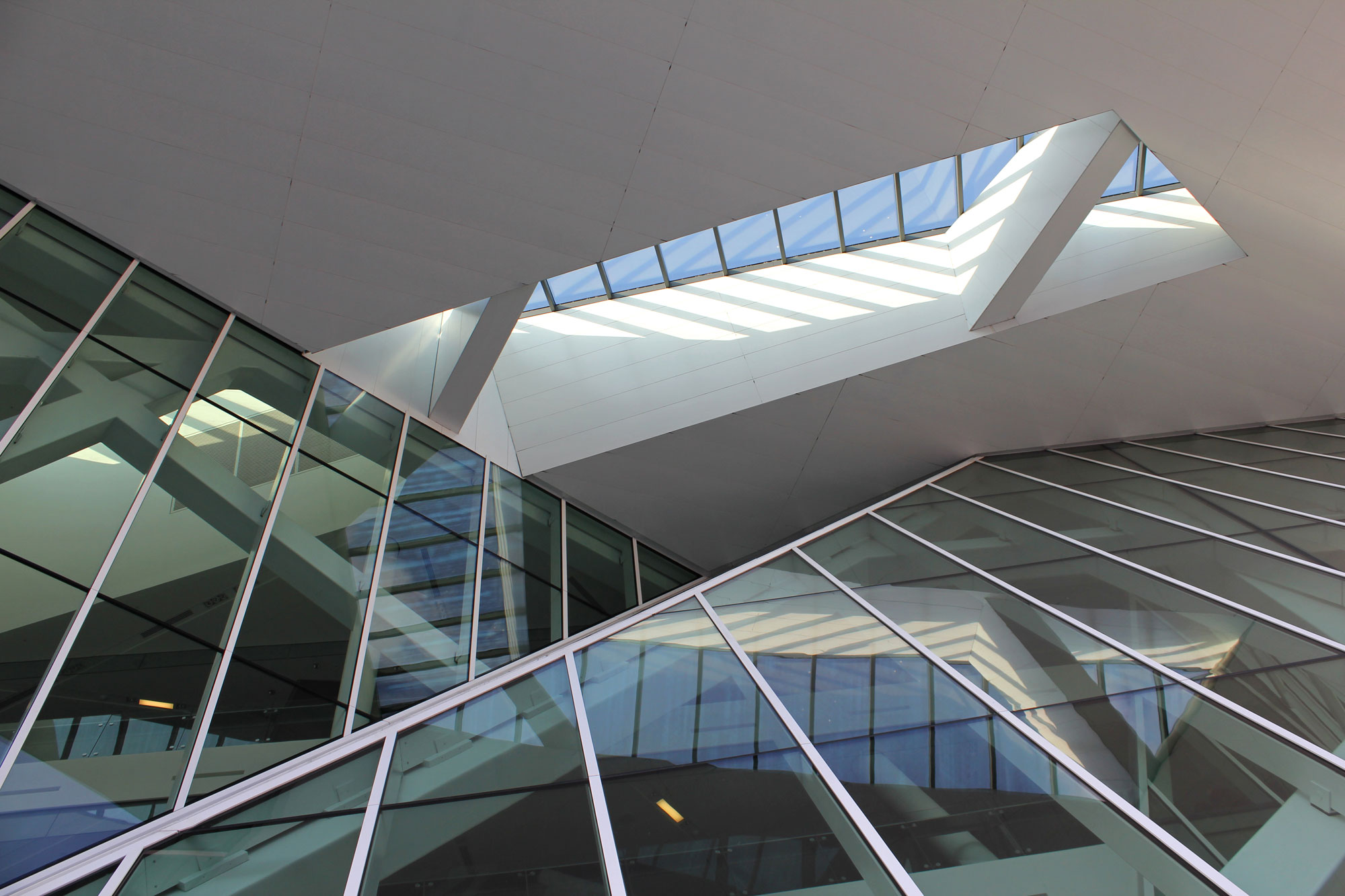
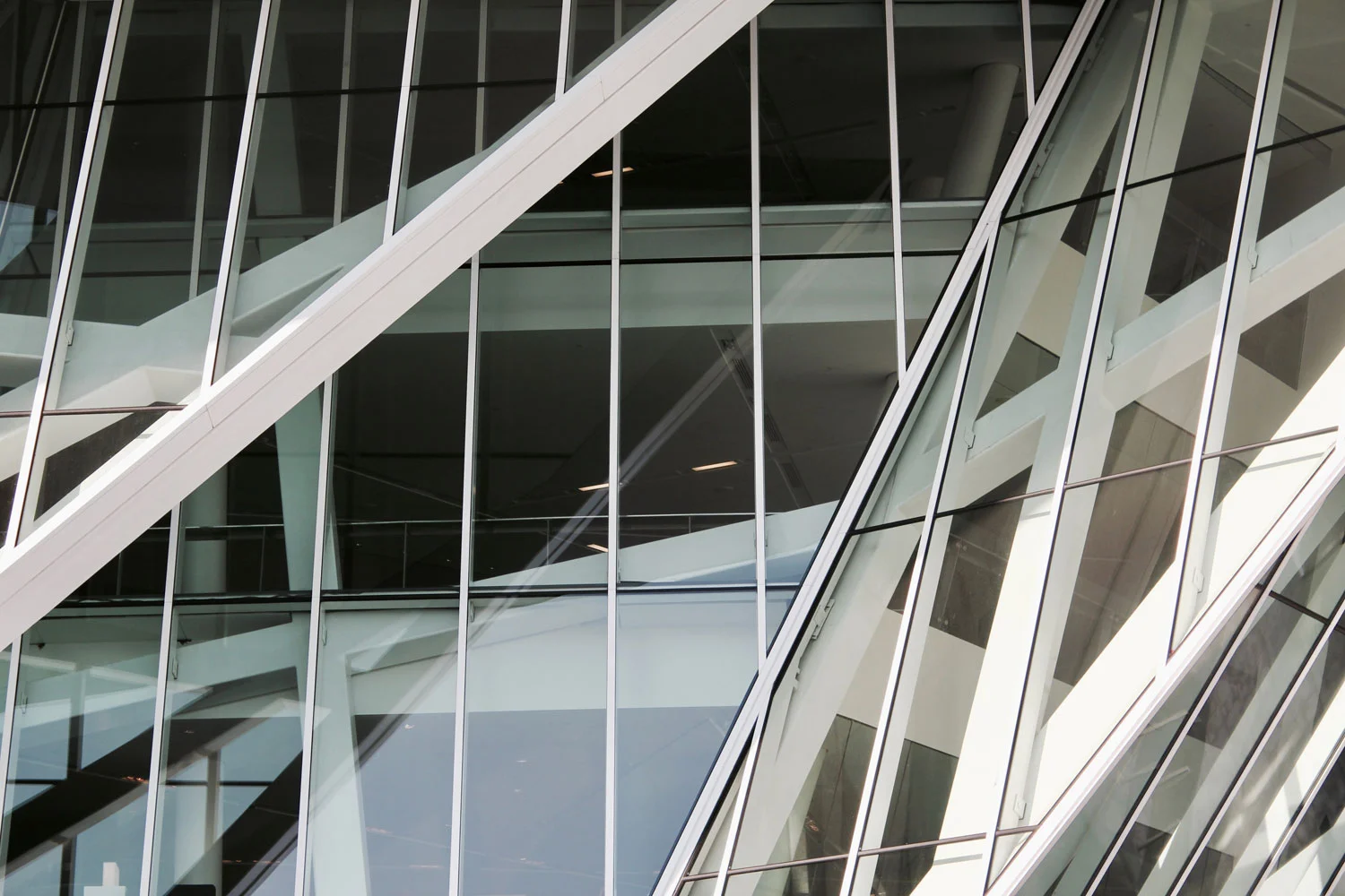
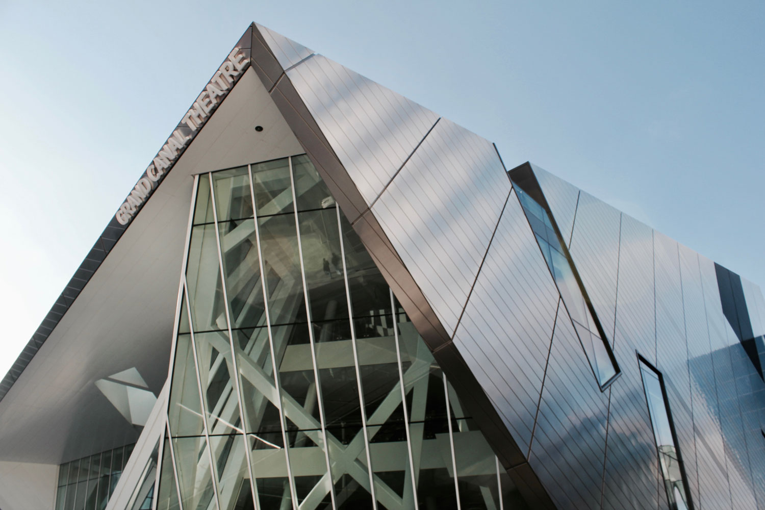
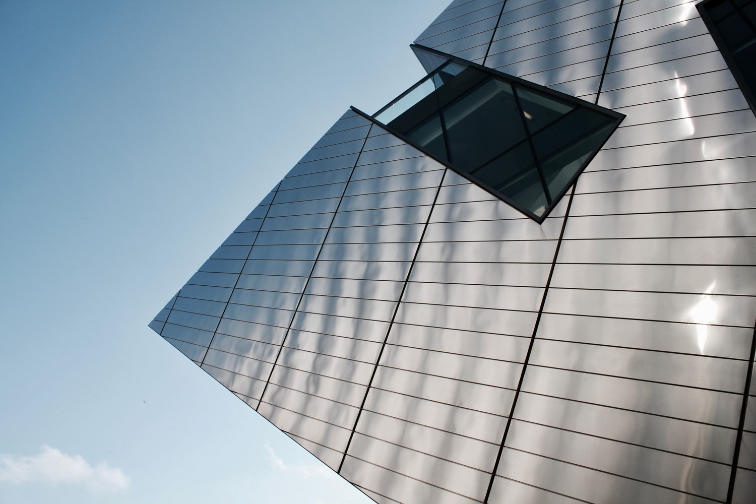
The Dublin Docklands area has historically been an important part of the city of Dublin, but it has always been a difficult place to establish an alliance between industry and urban livelihood. The proposed redevelopment of the area would need an identity that would be immmediately recognizable and associated with the place. That event would occur at the central core of the Docklands area, called Grand Canal Square, named after the historic Grand Canal that had connected trade cargo from Dublin to the River Shannon. The construction of the new square would be implemented months, and in some cases, even years before the rest of the Docklands development, in order to attract investment and excitement to the transforming neighborhood. At the heart of the new construction lies the Grand Canal Square Theatre, a structure that becomes the main facade of the large public piazza, framed by a five star hotel and residences on one side and an office building on the other. Architect Daniel Libeskind would be selected to lead a group of designers and engineers to complete the theatre with the concept to build a cultural presence on the site by sculpting expressionistic glass volumes to convey a fluid and open public dialogue with the cultural, commercial and residential surroundings, while presenting various programmatic forces essential to the Theatre’s operation. The faceted entrance facade acts as a theatre curtain, projecting the ‘stages’ of the building’s multiple level theatre lobby onto the projected public piazza, creating an active visual edge onto a dynamic civic space. The dynamic volumes and large geometric structural ribs can also be said to evoke imagery of the docklad area as a composition of rippled water with protruding ‘ribs’ of wooden piers.  

Calatrava’s Samuel Beckett Bridge crossing the River Liffey in Dublin’s Docklands area

Calatrava’s Samuel Beckett Bridge crossing the River Liffey in Dublin’s Docklands area

Looking down Chimney View toward Grand Canal Theatre

Looking down Chimney View toward Grand Canal Theatre

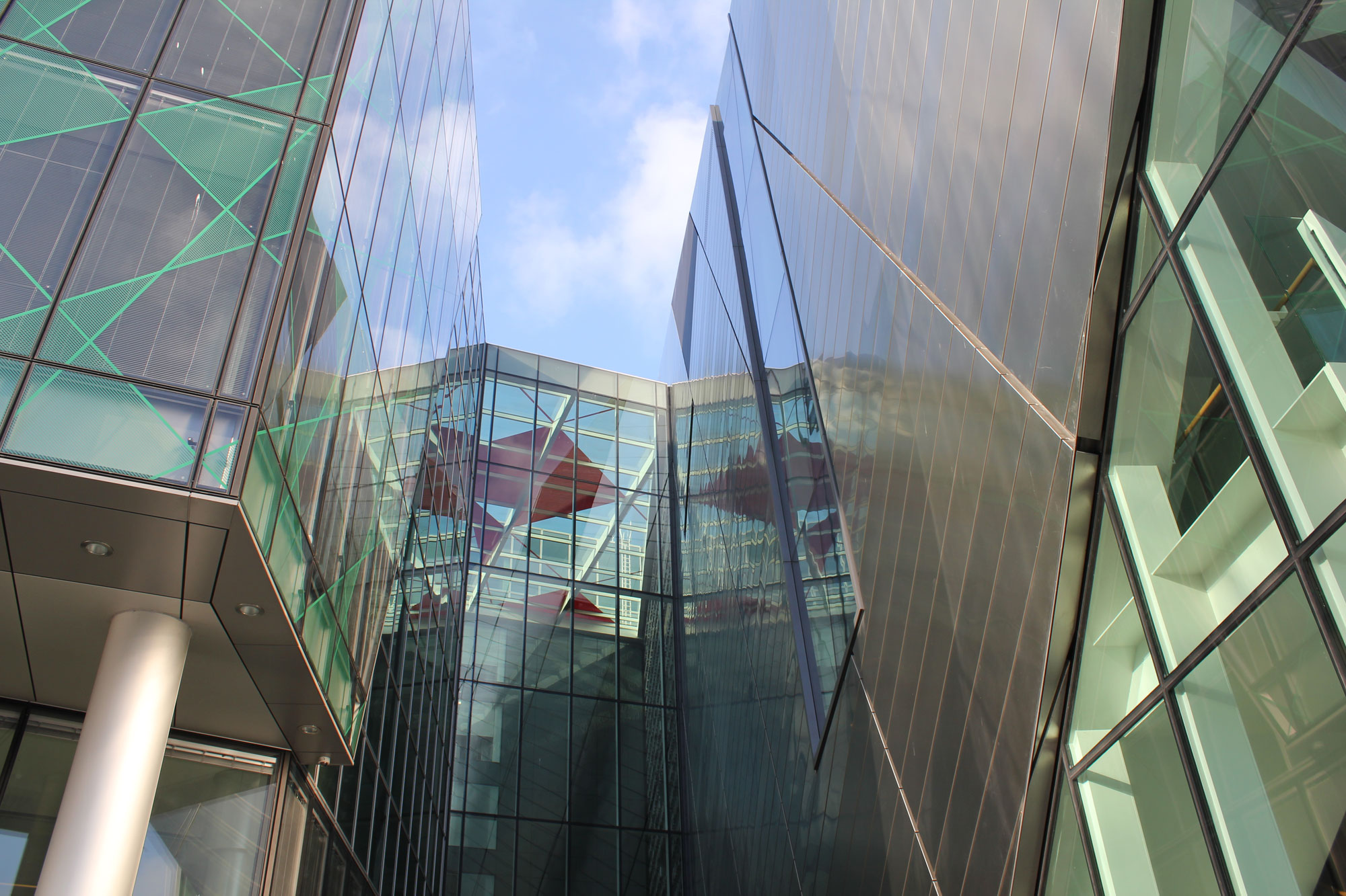
The Grand Canal Theatre is integrated into the planned commercial development of the Docklands by twin office buildings designed by Libeskind, flanking the theatre to the north and south and containing almost 500,000 square feet of leasable office and retail space. Like the Theatre, the office buildings provide multi-story glazed atriums with similar facade articulations, visually integrating the buildings with adjacnt retail, cultural and public space components. South Block and North Block, as the twin offices are named, help reinforce the boundary of the new urban square and form a theatrical gateway to Dublin Harbor.

Grand Canal Square

Grand Canal Square

Site Section

Site Section

IMG_7551.jpg
IMG_7547.jpg
IMG_7570.jpg
IMG_7580.jpg
IMG_7609.jpg
IMG_7585.jpg

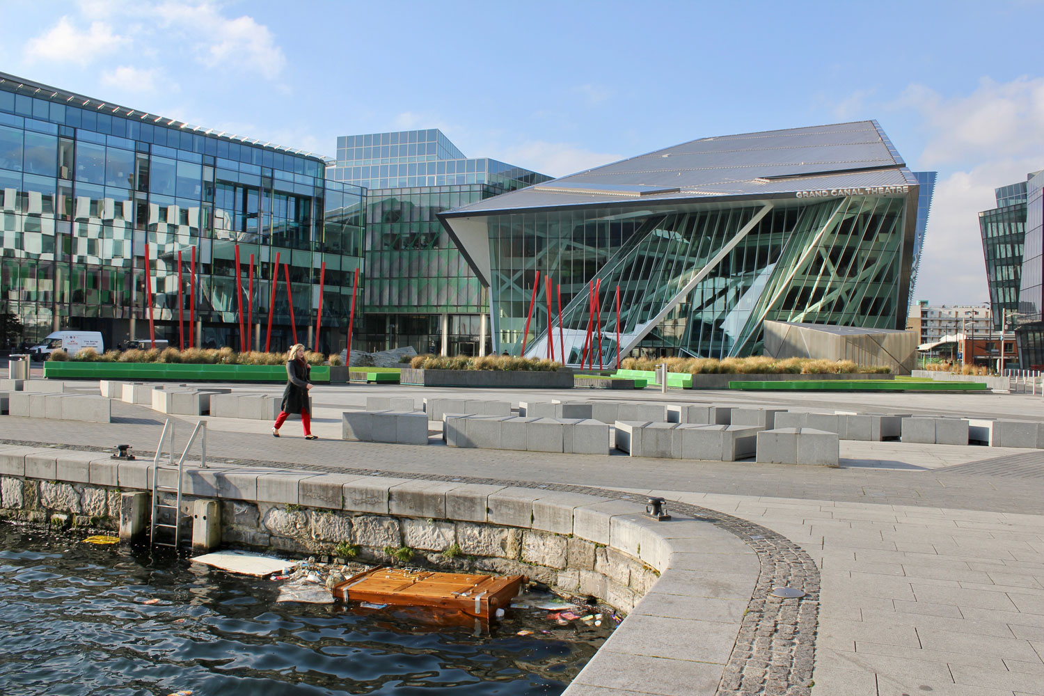
Libeskind’s design for the Grand Canal Theater delivered a clear and compelling aesthetic to the newly-formed district, so rather than confront it with a conflicting language the designers of Grand Canal Sqaure (Martha Schwartz Partners) embraced the angularity of the entry facade down to the ground plane, uniting the building and landscape into one larger compostion with a singular identity. The piazza compliments the interiority of the Theater, acting as a grand outdoor lobby, itself becoming a stage for civic gathering with the dramatic theatre elevation as a backdrop offering platforms for viewing. Most notably, is the fragmented paving pattern across the entire open space, with sharp lines seemingly continuing off the building’s architecture, creating a varied networks of paths that reach out into the surrounding context to attract people into and through the new plaza. 

Site plan of Martha Schwartz Partners' design for Grand Canal Square

Site plan of Martha Schwartz Partners' design for Grand Canal Square

Grand Canal Square Materials

Grand Canal Square Materials

“The initial focus in people’s minds was on development and on the buildings, but no matter what the quality of the individual buildings, people’s overwhelming sense of place was going to be determined by that public space and the public realm of the wider district.”
— Martha Schwartz
IMG_7626.jpg
Grand Canal Square

Grand Canal Square

In a bold statement, the designers created a ‘red carpet’ that cuts across though the square and up to the theater’s entrance, signaling that the “theater is open to the world”. The other end of the carpet extends out over the canal to the west, inviting visitors to connect with the waterfront  and the Dockland area. This move is further emphasized with 23-foot high red light poles angled out of the surface of the square, enabling color and energy to an otherwise colorless landscape (parking garage below limits much vegetation growth). The light poles serve to soften the hardscape while breaking down the scale shift between the Theater and the expansive ground plane. The composition of both the square and Theater creates a dynamic urban gathering space, one defined by visual relationships, connection points and porous infastructure. It is a performance space both inside and out. 

“The concept….is to build a powerful cultural presence expressed in a dynamic volume. This volume is sculpted to express the various forces which create the urban piazza, the public space and inner workings of the theatre. This composition creates an icon that mirrors the joy and drama emblematic of Dublin itself.”
— Daniel Libeskind, Architect
Grand Canal Theater  /  Site analysis of access, circulation, new development, and points of social engagement

Grand Canal Theater  /  Site analysis of access, circulation, new development, and points of social engagement


tags: City Context
categories: Ireland, Rotch Case Studies
Sunday 01.29.12
Posted by Christopher Karlson
 

Ireland / Absorption into the Landscape

O'Brien Castle and the Cliffs of Moher

O'Brien Castle and the Cliffs of Moher

Referencing architect Sarah Lappin, a common practice for many designers in Ireland is an absorption of the landscape, both with built and unbuilt work. Lavished as the country with ‘a million shades of green’, much has been written about the beauty of Ireland, and an effort to re-create ‘civilized’ work from centuries of European artists, musicians, and poets will not be attempted here. Instead, the people of this island nation - historically battered economically and politically for centuries - find guidance and an untroubled expression in their natural surroundings. But, to understand the Irish landscape is to comprehend a battered coastline of cliffs, rolling farmland, bleak hillsides of fissured limestone pavement, vast peat bog lands and the northern light that continuously affect a reading of them. The commonality that threads all these juxtaposed conditions is a landscape that is permeated by water, whether through its proximity to the coastline or to lakes, rivers, bogs and marshlands, and it is the way that precipitation moves through and over the ground that determines the visual form of the environment.

View from Rock of Cashel

View from Rock of Cashel

Dunguire Castle

Dunguire Castle

Limestone perimeter wall around farmland

Limestone perimeter wall around farmland

Looking up castle tower

Looking up castle tower

Visitor Center for Cliffs of Moher

Visitor Center for Cliffs of Moher


tags: Landscape
categories: Ireland
Wednesday 01.18.12
Posted by Christopher Karlson
 

Context / Dublin, Ireland

IMG_8687.jpg

Neatly divided by the Liffey River, the capital city of the Republic of Ireland has had a recurrent history of both opulence and hardship. Originally established as a Viking settlement in the 9th century, the British crown would claim sovereignty over the area following a Norman invasion centuries later, establishing the major defensive work of Dublin Castle as the center of English power for 700 years. Dublin would immediately prosper under new English control as a major trade area and become center of administrative rule in Ireland, leading to such prominent establishments as Trinity College, Ireland's oldest university. By the 17th and 18th centuries, Dublin had grown to the second largest city in the British Empire (5th in Europe) and during this period is when a vast majority of the city's most notable architecture and famous urban districts were developed. However, by the time of the Industrial Revolution, Dublin was seen to play no part in the historical movement, due to the passage of the Act of Union in 1800 that would transfer the city's seat of government to Westminster Parliament in London, leading to a period of economic and political decline. The Great Famine in the 1840s would make things worse, leading to a million deaths and over a million more emigrated to escape it, with over half of all immigrants to the United States from Ireland. The population of Ireland would not recover from that period, never returning to its 1840s level (8.2 million) since. The 20th century saw the rise of modern Irish nationalism and the 'Easter Rising' of 1916, which would led to an Irish Civil War resulting in significant amount of damage to Dublin's city center and the ascension of an independent Ireland. 

Waterfront along the Liffey River

Waterfront along the Liffey River

Dublin Infastructure

Dublin Infastructure

Trinity College campus

Trinity College campus

At first glance, modern Dublin can be characterized by its simplicity and informality, living off a Georgian Dublin aesthetic from the heyday of centuries past. Most buildings entail large proportions or grand spaces, but with little extraneous adornment, a much simpler model to the decadence of their European neighbors, which has much to do with the country's long run of economic constraints over simplistic design intentions. But what Dublin lacks in architectural ambitions, makes up for in civic vibrancy. Looking south of the River Liffey, you will find the bustling redeveloped district of Temple Bar, academic exuberance of Trinity College and, just below it, the pedestrianized shopping area of Grafton Street, leading to the city's St. Stephen's Green (the city center's largest park). Move north, over the river, along the major north-south traffic thoroughfare of O'Connell Street and you encounter an urban context that is more monumentalized and sterile, with numerous government institutions and high-end shopping centers. The most notable instance in the area is the Monument of Light, the tallest structure in Dublin, which denotes the intersection of two important streets: A major north-south traffic thoroughfare of O'Connell Street and the main pedestrian shopping area of Henry Street. 

Dublin Castle

Dublin Castle

Aviva Stadium in Dublin's Ballsbridge area, designed by Populous (formerly HOK Sport)

Aviva Stadium in Dublin's Ballsbridge area, designed by Populous (formerly HOK Sport)

In the 1990s and 2000s, fortunes for the island nation were about to turn from bleak to incredibly opportunistic, as suddenly the Irish were among the richest people in Europe with a booming economy. Politicians and property developers were anxious to take advantage of the positive economic landscape, adding much needed modernization to Dublin's architectural scene. Most of the focus was on the East side of Dublin, where high-profile projects such as the Dublin Docklands city quarter and the new Aviva Stadium were completed. Architectural historian Jean-Louis Cohen, writing in 2001 in the midst of economic prosperity, saw a tension between the booming Irish economy and the aspirations of architects who espoused critical regionalism in the late eighties and early nineties. He calls the approach of contemporary Irish architects “critical internationalism”. This approach allows for “research for a local specificity” while not precluding “a series of cross positions defining a common intellectual space. The increasingly international character of capital, clients, and uses in Ireland allows – perhaps forces – a direct connection to architectures happening throughout the world and in Europe especially." It had been decades since Dublin had seen this much construction and development. Now that Ireland went from an economic high to a disastrous low....again, the country can reflect on the impact of this new society and architecture, letting the projects mature and see if they can truey be expressive of 'an Irishness' in built form. 

Calatrava's Samuel Beckett Bridge crossing the River Liffey in Dublin's Docklands area

Calatrava's Samuel Beckett Bridge crossing the River Liffey in Dublin's Docklands area


tags: City Context
categories: Ireland, Rotch City Contexts
Tuesday 01.10.12
Posted by Christopher Karlson
 

All images © 2010-2020 Christopher Karlson